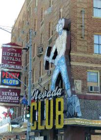
| s/y Nine of Cups American Odyssey 2012 - Part I: Las Vegas to Denver (the long way) Cross-country land cruising - April-June 2012 |
| While in Vegas, we weren't totally idle. Beyond doing house projects for David's mum and sis, catching up on past due medical check-ups and just general catching up, we've managed some fun daytrips. Here's a sampling. While you're waiting for our 2012 road trip to begin, take a look at our cross country trip of 2010. |
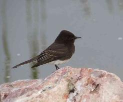
| Black phoebe at Clark County Wetlands Park |

| Mary's special brunch...just because |
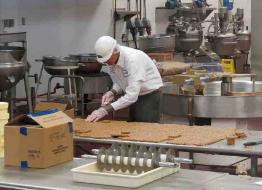
| At Ethel M's, we toured this gourmet chocolate factory created by Forest Mars, of the Mars candy family. We watched candy being made, sampled some of their wares and then toured the adjacent botanical garden devoted to native desert flora. |
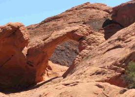
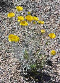
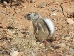
| We revisited Valley of Fire. Just an hour from Las Vegas, Valley of Fire offers red sandstone rock formations and desert flora and fauna ... a whole different world from the glitz of the Strip. From left, desert marigold in bloom; Arch Rock; an antelope ground squirrel and a black-throated sparrow enjoying some globe mallow. |

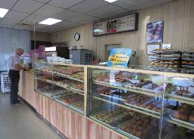

| Our daughter-in-law's birthday had us visiting Ronald's Donuts in the Chinatown section of Las Vegas to buy her some world renowned vegan donuts. Who knew? |
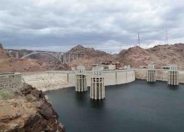

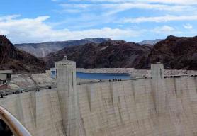
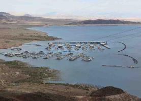
| Hoover Dam, considered one of the world's greatest engineering feats, it rates right up there with the Pyramids and the Panama Canal. The mighty dam corrals the Colorado River as it winds through the Black Canyon on the Nevada-Arizona border. The hydro-electric plant supplies power to Nevada, Arizona and southern California and is financially self-sustaining. America's largest man-made lake, Lake Mead, provides an exceptional recreational area and touts eight marinas. |
| And we're off! First stop...out of this world |
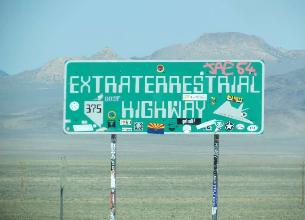
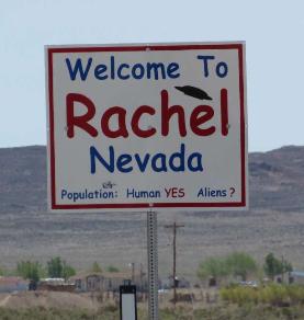
| We left Las Vegas bright and early on 29 April 2012. We're eventually heading east, but we've planned a rather circuitous, ambitious itinerary to get there...by heading first to California. We began immediately with a little detour northwest of Las Vegas to Rachel, Nevada, home of the notorious Area 51, an ultra-secure US military base where purportedly alien spacecraft and crew are secretly being held and studied. |
| This page will be our main routing page through the States. We've created separate pages for National Parks/Monuments/ Landmarks that we visit and we'll link to them from this page. Because we enjoy "off the beaten path", quirky kind of places, we've also created a Roadside Americana page for your viewing enjoyment which includes an ecclectic grouping of all things that strike our fancy or give us pause for thought. What good's quirky if you can't share it? |
| Welcome to Rachel |
| They've even dubbed Rte 375 as Extraterrestial Highway. |
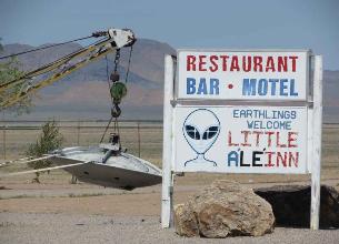
| The Little A'Le'Inn (motel and restaurant) has a good time with the alien theme. |
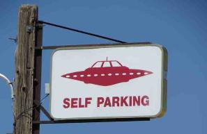
| Parking was no problem. |
| Some of the tourists had obviously come much farther than we had, but they didn't talk much about their home towns. |
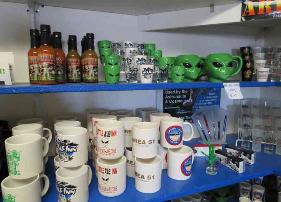
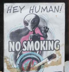
| All things alien were for sale. |
| From Rachel, we made our way through the Mojave Desert to Beatty, Nevada. Take a look at the hottest, driest, lowest place in the USA. Death Valley National Park. |
| It may be home, but the Denver area has lots to offer and explore and we don't intend to sit still while we're here. So come along as we see what's new in the Mile High City. Remember, our arrival in Denver is only Part I of this Odyssey. Come with us as we head from Denver to Boston on American Odyssey Part II. |
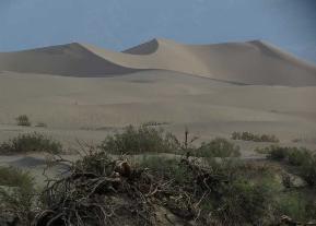
| We were hot and parched when we left Death Valley. After looking at the map, we opted for a 2-lane country road, Rte 178 as a western exit from the park. What a gem of a road...it even has its own website. It encompassed several different bio-regions from desert to sierra to chapparal to winding canyon rivers. |
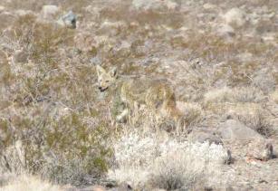
| Not a mile down the road, we saw a coyote running through the sagebrush. His tawny coloring matched so well with his surroundings, it was hard to pick him out. |
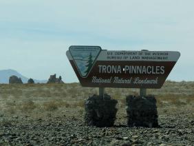
| Route 178 - The Trona Pinnacles - Trona, CA |
| Now this was an unexpected delight. We could see the Trona Pinnacles from quite a distance away, jutting up in ragged peaks from the desert floor. "The Trona Pinnacles were designated as a National Natural Landmark in 1968 to protect one of the nation's best examples of tufa formation." Hmm...so what's a tufa formation, you ask? This unique landscape consists of more than 500 tufa (calcium carbonate) pinnacles rising from the bed of the Searles Dry Lake basin. These tufa spires, some as high as 140 feet, were formed underwater 10,000 to 100,000 years ago when Searles Lake formed a link in an interconnected chain of Pleistocene lakes stretching from Mono Lake to Death Valley. Pretty impressive, huh? |
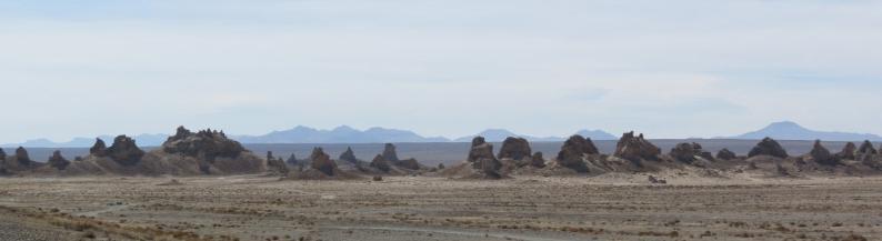
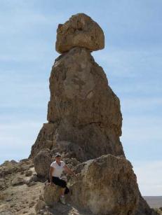
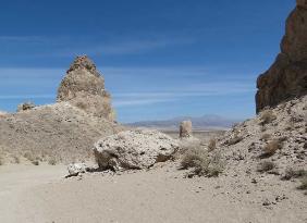
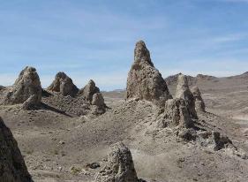
| It was even more impressive to be wandering around amongst them .Interpretive signs provided information about their formation and geologic significance. Access was via a rough, dusty unpaved road and had we not chanced to read about them in advance, we never would have stopped. Evidently, local folks come out here at night with a full moon for what they term a "supernatural" experience. |
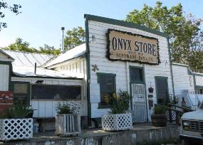
| Continuing along Rte 178, we were disappointed that the Onyx Store, California's oldest continuously operating general store (1851) was not open when we arrived. |
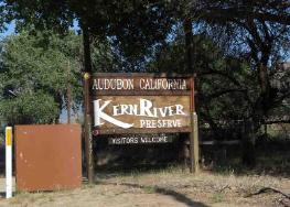
| A morning visit to the Kern River Preserve was disappointing. We heard zillions of birds, but got very few photos. The walking paths were pleasant , but the mosquitoes and ticks were not. |
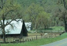
| The road passes through several different bio-regions including some grassy hills and paddocks where bucolic scenes of pasturing livestock reigned. |
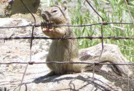
| We picnicked near a field which was heavily populated by California ground squirrels that provided the luncheon entertainment. Above...."Jailed" |
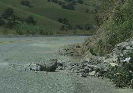

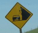
| First the sign, then the rockfall. |
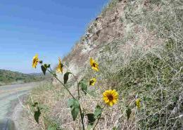
| Prince's plume and sunflowers lined the roadside lending color to the desert and granite cliffs as we descended into the valley below. |
| Continuing down Scenic Byway Route 178 |
| At the movies...Planet of the Apes, Star Trek, ER (TV episode), Holes and Lost in Space all had parts filmed at the Trona Pinnacles. |
| From Death Valley NP, we headed back along the west side of the Sierra Nevadas for a visit to Sequoia and Kings Canyon National Parks and then on to Yosemite NP. Along the way, we found lots to amuse ourselves including a roadside poster announcing the Mariposa Butterfly Festival. |
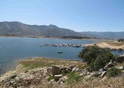
| A small marina at Isabella Lake reminded us that we missed Cups. |
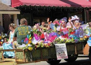
| Mariposa Butterfly Festival |

| California Scenic Route 178 has its own website. |
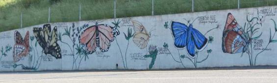
| A colorful butterfly mural in the center of town says it all. Local townsfolk donate money each year to purchase butterfly larvae. The local school kids tend to the larvae until they hatch and learn about the process in school. As the butterflies hatch, they are kept captive until the festival when the children participate in their release. |
| The butterfly lady brings out netted baskets for the release of hundreds of painted ladies. |
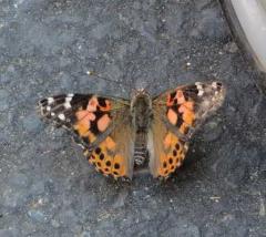
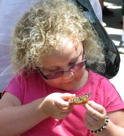
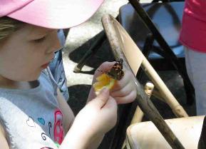
| It is estimated that there are ~18,000 - 21,000 species of butterflies in the world. Above, a painted lady |
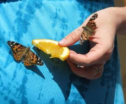
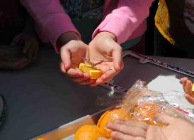
| Watching the children's faces as the butterfly lady handed each child a slice of orange and then a butterfly to sit upon it, was a wondrous thing. They were gently in awe, careful with their fragile beauties. Some smiled in delight, others cried as their butterflies took to wing and flew away. |
| It was a festive day in this little town (pop: 2173) with much applause as the newly crowned Little Miss Butterfly flew by. |
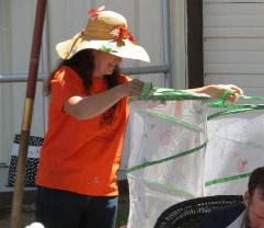
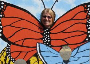
| Marcie morphed into a butterfly for the day. |
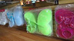
| Despite her whining, David refused to buy Marcie a pair of gossamer wings which she had planned to wear for the rest of the trip. |
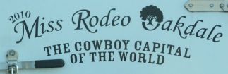
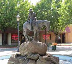
| We saw this little sticker on the van in front of us at a traffic light. "Cowboy Capital of the World" caught our attention. Oakdale wasn't far away and so once again, we were off the beaten track heading to the Cowboy Capital which led us to Route 49 and Gold Country. |
| Gold Country - Following the path of the 49'ers |
| The California Gold Rush (1848–1855) began on January 24, 1848, when gold was found by James W. Marshall at Sutter's Mill near Coloma, California. News of gold brought some 300,000 people to California from the rest of the United States and abroad. Of the 300,000 gold-seekers, called "forty-niners" (as a reference to 1849), approximately half arrived by sea and half came from the east overland on the California Trail and the Gila River trail. |
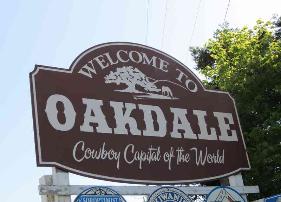
| Seems Oakdale IS the cowboy capital of the world! WOW! |

| The cowboy museum was closed unfortunately, but we did get a chance to see this huge bronze in the park and learn more about the Testicle Festival held annually. |
| Known as the Mother Lode Road or Golden Chain Highway, Rte 49 snakes its way through historic little mining towns with names like Placerville, Murphys, Chinese Camp and El Dorado. We stopped at Columbia "the gem of the southern mines" to explore their reconstructed 1850's town. It was too touristy for our taste. |
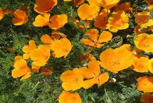
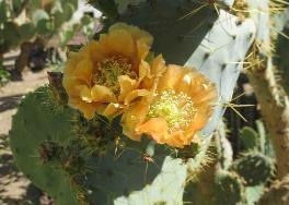
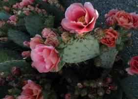
| California poppies (above) and prickly pears (below)were in bloom along the roadside. |
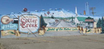
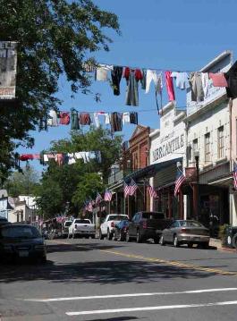
| The very best town, however, was Angels Camp named after Henry Angel, a shopkeeper from Rhode Island who opened a trading post in 1848 after deciding this would be a more profitable use of his time than digging for gold. Thus the town of Angels Camp was founded. We knew it would be a fun stop when we saw laundry hung out on lines strung up above main street. |
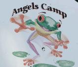

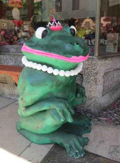
| Not only is the town in gold country, but it's in Calaveras County, made famous by Mark Twain's Celebrated Jumping Frog. There are several bigger-than-life celebrity frogs all over town. |
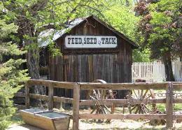
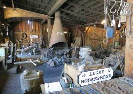
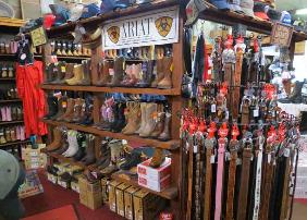
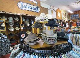
| We wandered through a local store where boots and hats took up the majority of floor space. |
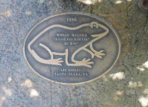
| Each year's jumping winner gets a bronze plaque embedded into the main street sidewalk. |
| Across the Sierra Nevadas |
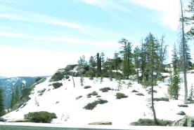
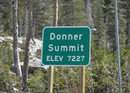
| We traveled from California over the Sierras into Nevada. We passed through little towns like Rough and Ready (photo far left). Wildflowers were in bloom and lined the highway with color. We crossed over Donner Summit, historic site of the ill-fated Donner Party. Snow still covered the roadside and the pass. |
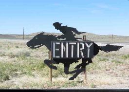
| US Route 50 - Loneliest Road in America |
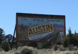
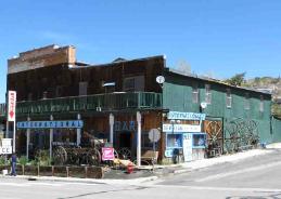
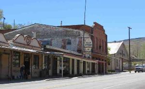
| Austin was the first "lonely" town we visited. The town was one of Nevada's most prosperous mining towns and has managed to retain its 19th century flavor. From left, Welcome to Austin. The International Hotel, first built in Virginia City in 1859 and moved to Austin in 1863 still serves meals and drinks, but does not rent out rooms. It's said to be the oldest hotel in Nevada. Today Austin is a "living ghost town" (population: 192), a well-preserved example of an early Nevada mining town. Stokes Castle, an exact replica of a tower outside Rome, Italy, was built in 1897 for as a summer home for an eastern financier who had considerable mining interests in the Austin area. |
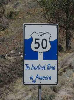

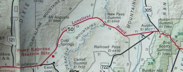
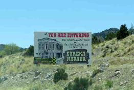
| In July 1986, Life Magazine described the 287 mile stretch of Nevada's Highway 50 between Fernley and Ely as the "Loneliest Road in America"...no attractions, no points of interest and in fact, it recommended "survival skills" to drive it. Nevada marketed it to the hilt as did the little towns along the route. We picked up our "Survival Guide" and headed west...hoping to survive. |
| Sand Mountain is a 2-mile long mound of sand dunes rising several hundred feet. |
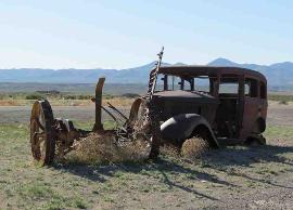
| Middlegate Station didn't offer much except for photo opps. |
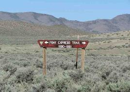
| Rte 50 has been a pathway of travel for decades. The Overland Stage followed this route, then the Pony Express and the transcontinental telegraph. The Lincoln Highway, America's first coast-to-coast highway, followed part of this route as well. |
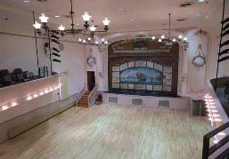
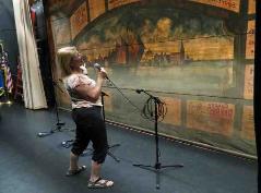
| Eureka, a mid-19th century silver and lead mining town, was quite interesting and next along our route. From left, Welcome to Eureka, the "friendliest town on the loneliest road". The Eureka Opera, built in 1879, has been restored to its original splendor and boasts the actual 1924 advertising curtain. We were allowed to take a self-tour behind the curtain and Marcie couldn't resist belting out a tune backstage. |
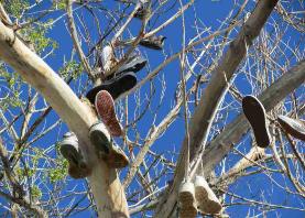
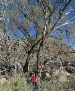
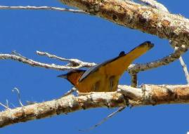
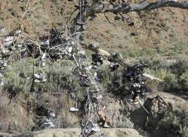
| The "Old Shoe Tree" is a giant cottonwood filled with hanging shoes. We're not talking a few pair of shoes...we're talking hundreds of pairs. There were several pair on the ground and David rescued them to try his hand at flinging them on the tree...not an easy task, he found. Some of shoes had been there so long, they were used by the local birds for nests. A Bullocks oriole takes a look at what nest potential might be available. |
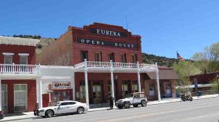
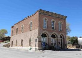
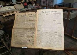
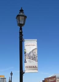
| In its heyday, Eureka supported 100 saloons, dozens of gambling houses, theatres, an opera house, churches, fine hotels, bordellos and five fire companies. From left, a main street lamp post; the Eureka Museum, former location of the Eureka Sentinel which began publication in 1870 and continues today as a weekly newspaper. The current Raines Market, with its eclectic stock and animal heads decorating its walls, was previously a drugstore, a restaurant, a shoe store, a saloon and an assay office. |
| Ruth was originally the location of the Consolidated Copper Company. It's an open pit copper mine, still worked today. It's a depressing area and Stephen King having visited the area got the inspiration for his novel "Desperation". |
| Ely, the largest town on Rte 50 offered casinos, restaurants and respite for weary travelers. |
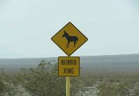
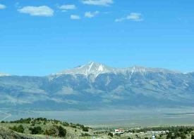
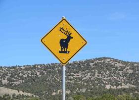
| As we left Ely, we began to climb. Warning signs for elk and free-range cattle and stock were posted every few miles. The views of the Snake Range as we left Ely were breathtaking. There are a dozen mountain pass summits to be crossed before we arrived in Baker, NV and Great Basin National Park. |
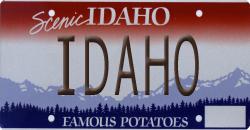
| Idaho and all things potato |
| National Parks and Monuments? Roadside Americana? Birds of North America? Wildflowers of North America? |
| From Great Basin, we crossed from Nevada north into Idaho and headed to Hagerman Fossil Beds National Monument along the Thousand Springs Scenic Byway. We'd never spent much time in Idaho before and it's absolutely beautiful. |
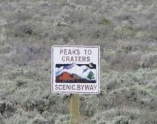
| The Peaks to Craters Scenic Byway took us to Craters of the Moon National Monument. |
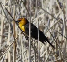
| Carey Lake Wildlife Preserve provided a unique opportunity to view yellow-headed blackbirds. |
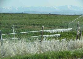
| Mornings were cold as evidenced by the irrigation water freezing in icicles along the barbed-wire fence. |
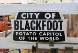
| We headed to Blackfoot, Idaho, potato "capital" of the world. Oops...they made a grammatical error! |
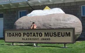

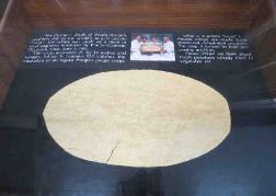
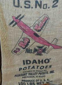

| Our single-minded purpose for visiting Blackfoot? The Idaho Potato Museum. |
| This was a fun place. Of course, they had potato farming equipment, but |
| also the world's largest potato crisp according to Guinness Book of World Records... |
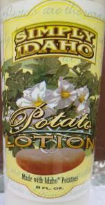
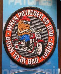
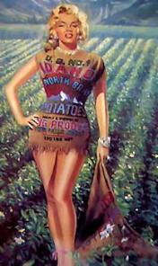
| But wait, there's more! Potato vodka, potato hand lotion (it smelled definitely earthy), biker patches for "when potatoes go bad", potato sacks and my personal favorite, Marilyn wearing a potato sack (I should have ever looked so good!). |
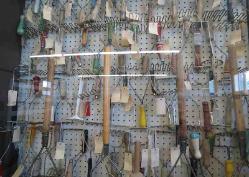
| and two walls of potato mashers, too! |
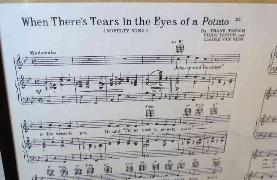
| There was potato music and who could forget Mr. Potato Head? Of course, the couch potato made the scene and even their license plates tout the mighty tuber. |
A little potato trivia...
|
|
|
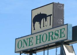
| We stayed at the One Horse Motel in West Yellowstone, MT a couple of nights because of its close access to Yellowstone National Park. |
| On the move to Wyoming |
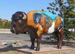
| Many towns we've seen construct statues of their most famous animals and have local artists decorate them. West Yellowstone chose buffaloes and they were all over town. |
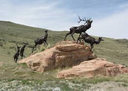
| We headed south from Yellowstone to Grand Teton National Park and then enjoyed a pleasant day in Jackson Hole, Wyoming. Above, "Wapiti Trail" at the National Elk Refuge. |
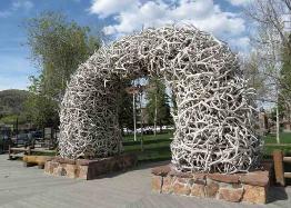
| An antler arch adorns each of the four entrances to Jackson Hole's town square. |
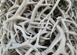
| A close-up of the elk antlers which are collected at the National Elk Refuge by Boy Scouts each Spring when the bull elks shed them. |
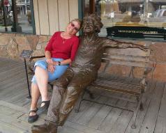
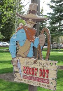
| Jackson Hole is a fun town with lots of cowboy bars and street art...even a daily shoot-out on the town square (except Sundays!). Marcie poses with Al (Einstein), a large sidewalk bronze. |
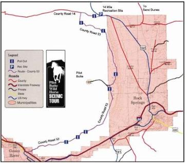
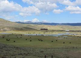
| From Jackson Hole, we headed south towards Utah with a few stops along the way: Fossil Butte National Monument in Kemmerer, WY for some fossil viewing. Then, the gravel roads of Seedskadee National Wildlife Refuge provided lots of wildlife viewing along the Green River. We found a reference to the Pilot Butte Wild Horse Loop near the town of Green River, WY in the Wyoming Travelers Guide and decided to check it out ourselves. |
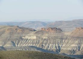
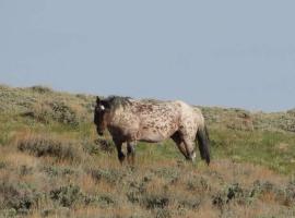
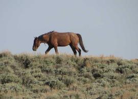
| Pilot Butte Wild Horse Loop |
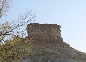
| Pilot Butte, at nearly 8,000' can be seen for 30 miles and was a prominent landmark used by pioneers to "pilot" them to the Green River. |
| There is probably nothing more iconic in the west than a wild horse. Whether galloping across the prairie or grazing peacefully at a distance, their presence conjures up images of freedom and the frontier. |
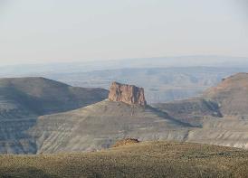
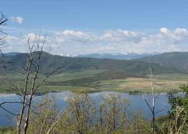
| We climbed to the mesa-like flat top of White Mountain for spectacular views. Interpretive signs along the route provided some insight to the wild horses as well as the historical and geological significance of the area. |
| After becoming extinct in America for unknown reasons, the Spanish reintroduced horses in the 1500s. Current herds are descendants of those Spanish horses, along with animals turned out by ranchers or enticed away from ranches by wild horse herds. The majority of wild horses in Wyoming are located in the southwestern part of the state. Approximately 1,100 to 1,600 wild horses can be found on the public lands in this area. We were hoping to see a few. |
| Flaming Gorge National Recreation Area is primarily located in Utah. The centerpiece of the recreation area is the 91 mile (145.6 km) long Flaming Gorge Reservoir created by damming of the Green River in 1964. The area was given the name "Flaming Gorge" by explorer and geologist, John Wesley Powell, during his 1869 expedition down the Green River due to the spectacular red rock cliffs that surround the river in this area. |
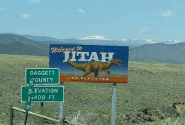
| Welcome to Utah - Flaming Gorge National Recreation Area |
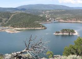
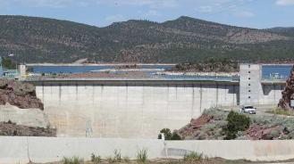
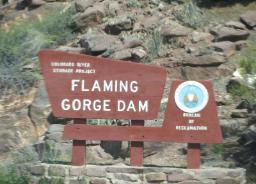

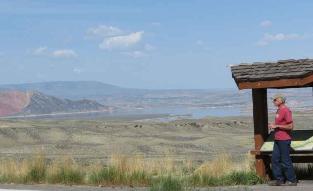
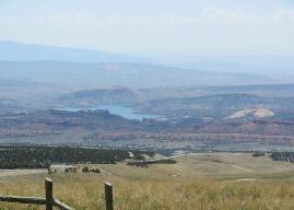
| We drove across the Cart Creek Bridge and the Flaming Gorge Dam, stopping for a quick look-see. We continued along the Flaming Gorge Scenic Byway, climbing in elevation for great views and vistas of the reservoir below. |
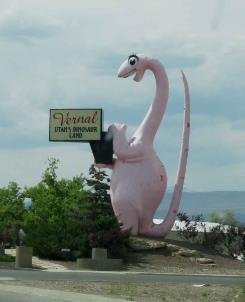
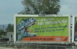
| Vernal, Utah ... entering Dinosaurland |

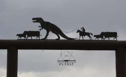
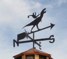
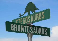
| We stayed the night in Vernal, Utah and got a serious kick out of the town's use of the dinosaur theme. A friendly-looking, long eye-lashed, 30' tall pink dinosaur officially welcomed us to “Utah's Dinosaurland”. |
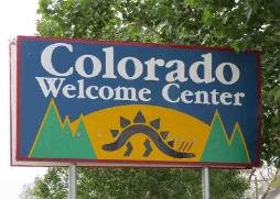
| In sharp contrast to the dinosaur-mania of Vernal, Utah, just over the border Dinosaur,Colorado is a poor, dusty don't-care-much-about-dinosaurs kind of town. Abandoned buildings with peeling paint and boarded-up windows and sad looking trailers comprised the main street attractions. The only presentable, welcoming building was the Welcome Center. |
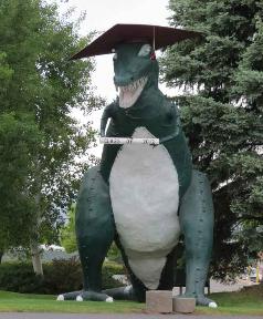
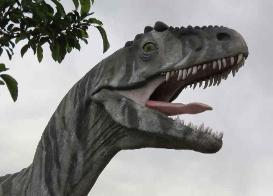
| There was a gigantic T-Rex in the town park sporting a graduation mortarboard and a 2012 diploma. Another T-Rex looked ready to eat us. |
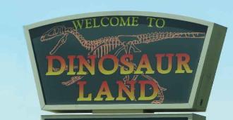
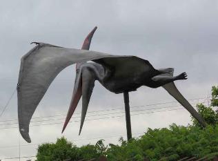
| Dino-Donuts, Dinaland 18 hole golf course, dinosaur museums, dinosaur weathervanes, gates, street signs and billboards all competed for our attention. |
| Welcome to Colorado |
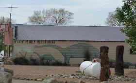
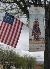
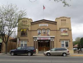
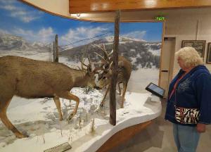

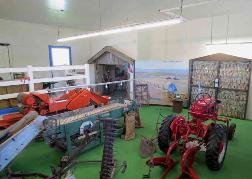
| Craig is a pleasant little town on Colorado's western slope. It's a real cowboy town. Men wear western-style jeans and cowboy boots and hats because it's what they wear and realistic clothing for what they do, not because it's a fashion statement. David's sister, Karen, lives here and we stopped for a visit. On Craig's main streeet is the Museum of Northwest Colorado. We've visited before. It contains memorabilia of the ranching and farming life here in the mountains, native American artifacts and an exceptional cowboy and gunfighter collection. The special treat this time was an exhibition of Saturday Evening Post magazine covers by Norman Rockwell. He did 323 covers in all for the post and all were on display. |
| The Saturday Evening Post was first published in 1728 by Ben Franklin. |

| Over the mountains, through the woods! It's been nearly two years since we crossed the Rockies and descended into Denver. The views are always breath-catching. You know that nostalgic feeling you get when you see familiar sights that you haven't seen in a long time. Our hearts were happy and our spirits were high and we were home. |
| Even a yellow-belllied marmot stood up tall to welcome us home. |